Coastal Zone Management in Sri Lanka

By Ananda Kodikara Assistant Director Department of Coast Conservation and Coastal Resources Management
INTRODUCTION OF COAST AND ITS MANAGEMENT
The coast is where land and ocean meet. If this line of meeting did not move, defining the coast would be easy it would simply be a line on the map, but the natural processes that shape the coast are highly dynamic, varying in both space and time. Thus the line that joins land and ocean is constantly moving, with the rise and fall of tides and the passing of storms, creating a region of interaction between land and sea. There are parts of the coastal environment that clearly have strong interactions between land and ocean, including beaches, coastal marshes, mangroves, sand dunes and fringing coral reefs; other parts may be more distant from the immediate coast (inland or out to sea) but they nevertheless play an important role in shaping it. One of the most important of these is the rivers that bring freshwater and sediment to the coastal environment. In this case, the inland limit to the coast is catchment boundaries that can be thousands of kilometers inland at the head of catchments. It is the most dynamic, resourceful and disaster prone zone of a country. but provides 25% of global productivity. 70% of the world’s population being within a day’s walk of the coast.
Asia has the largest coastline in the world of about 62,800 km 2.1 billion people in Asia live within 400 km of a coast
Sri Lanka unlike other Asian Countries with extensive Coast line. has a National coastal zone management program. which is best described in the “National coastal zone management plan”. This Plan is supported by the Coast Conservation and Coastal Resources management Act No.57 of 1981 which mandates the Coast Conservation and Coastal Resources management Department to manage the coastal strip The thrust of the plan is the allow development within this narrow area while preventing unnecessary environmental degradation pollution and erosion. This is accomplished through a regulatory mechanism which governs most activities in the coastal zone. It is designed to ensure sustainable use of the coastal environment and its resources in the long-term, while satisfying current national development goals.
In Sri Lanka the Coast Conservation and Coastal Resources Management Department (CC&CRMD) is the key agency responsible for the management of the coastal zone and its resources. The CC&CRMD’s objectives are as follows:
Ø To improve the status of the coastal environment
Ø Develop and manage the shoreline
Ø Improve the living standards of coastal communities
Ø Promote and facilitate economic developments based upon coastal resources
THE BIO-PHYSICAL CHARACTERISTC OF SRI LANKA COASTAL ZONE-
The coastal environment of Sri Lanka is influenced by its location in the northern part of the Indian Ocean, between 5° 54’ and 9° 52’ North Latitude and 79° 39’ and 81° 53’ East Longitude. The coastal area is positioned in the lowest of the three pen plains forming the island, and generally consists of flat coastal plains averaging an elevation of less than 100 ft (30 m) (CZMP 2004). The lowest peneplain containing the coastal plains extends outward from the island and under the sea as the continental shelf for a width of 5-25 miles (about 8-40 km) in most parts, and at an average depth of 216 ft (about 65 m) below sea level. The continental shelf is narrow around the southern part of the island, but widens considerably towards the north where it merges with the shelf around India. Sri Lanka has a coastline of approximately 1,620 km including the shoreline of bays and inlets, but excluding lagoons.
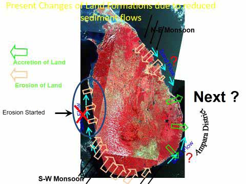
The transverse type coastline in the southwest and northeast is characterized by a series of pictures queue sandy bays protected on either side by rocky headlands; the southwestern coastline also has many complex systems of lakes and lagoons with sinuous shapes (CZMP2004). The bay of Trincomalee on the northeastern coast described as “the most perfect natural harbor of the Indian ocean is of particular significance. The northwestern and southeastern coastlines exhibit lagoons, sandbars, banks and spits that sometimes extend over many kilometers. The presence around the island of the continental shelf with shallow waters has permitted the formation of coral reefs along the coastline amidst well-developed reefs of sandstone and rock. Large deposits of coral are also found inland in the coastal region, particularly between Ambalangoda and Matara, chief among which are the Akurala deposits. Some segments along the southwest coastline are retreating due to natural erosive action of the sea compounded by anthropogenic activities such as river sand mining and destruction of the protective coral reefs. In contrast, some areas of the northwestern and southeastern coastlines are advancing due to accretion.
The coastal landscape contains a very dynamic transition zone between the sea, land and atmosphere, and is formed as a result of sea and atmospheric forces on the landmass and the supply of sediments to the coast. Sri Lanka has 103 rivers, most of which radiate from the hill country and flow down to the sea forming estuaries that are important features of the coastal landscape and provide vital habitats for species of commercial and subsistence use. These rivers transport large amounts of sand, silt and clay essential for beach nourishment; but they are also carriers of pollutants that degrade the quality of coastal waters and habitats. Throughout its length, the Coastal Zone contains a variety of terrestrial habitats that include sandy beaches, barrier beaches, sand spits and dunes, rocky shores, mangroves and salt marshes. Equally important are the coral reefs, lagoons, estuaries, and sea grass beds in the coastal waters. These systems help maintain vital physical processes, fulfill eco system services and functions and provide land, goods and services (CZMP 2004).
HISTORY OF SRI LANKA COASTAL ZONE MANAGEMENT-
Prior to the Establishment of the Coast Conservation Department, there was no sole agency in charge of the coast. Agencies such as the Public Works Department, Colombo Port Commission and Ceylon Government Railway shared responsibilities, particularly with regards to coastal erosion. Carried out coast protection work mainly focused on a “Hold the Line Approach” that was confined to construction of hard structures such as revetments, seawalls and groins.
.
In the 1960s the problem of coastal erosion worsened, leading to the establishment of a Coast Conservation Unit under the Colombo Port Commission in 1963. A Coast Conservation Division established under the Ministry of Fisheries and Aquatic Resources in 1978. This was followed by the introduction of the Coast Conservation Act No. 57, enacted in 1981.
Since 1983 Oct.1st the Coast Conservation Act, No.57 of 1981came into operation in the coastal zone, its resources and the development activities taking place within the coastal zone were primarily managed, based on the provisions of the above Act. During the course of planning and implementation of management, it was realized that, the vacuum of the provisions of the principle Act has created negative impacts on the planning and management outputs and outcomes. Accordingly, amendment to the principle act was made in 1988 through Coast Conservation Amendment Act, No.64. The 1988 amendments were mainly directed on enhancing regulatory powers on coral and sand mining activities, right of public access to the beaches and demolition of limekilns located within the coastal zone. With the expansion of scope of the coastal resource management over time and the increase of coastal issues due to both anthropogenic and natural phenomena, the requirement of new legal provisions have been long felt. The need for introducing new legal provisions surfaced in the areas of institutionalizing Special Management Area Process, legitimacy for community participation in collaborative management, expansion of legally defined coastal zone, managing human activities outside the coastal zone that have a direct impact on the coastal zone, managing public access and managing open spaces and access. In view of the above, the government introduced second amendment to the principle act through Coast Conservation Amendment Act, No. 49 of 2011. According to the amended act in 2011, The Department was renamed as the Coast Conservation and Coastal Resources Management Department.
According to Coast Conservation Act No.57 of 1981 published the first ever “Coastal Zone Management Plan” in 1990. The Plan has thereafter been revised and updated in 1997, 2004 and 2018 to reflect the changing environment.
Summary-
Ø Coast Protection Unit in the Colombo Port Commission -1963
Ø Coast Conservation Division- Ministry of Fisheries- 1978
Ø Upgrade to a separate Department as Coast Conservation Department -1983
Ø Coast Conservation & Coastal Resource Management Department -2011
DEFINITION OF SRI LANKA COASTAL ZONE-
Coastal Zone means The area lying within a limit of 300 meters landward of the mean high water line and a limit of 02 kilometers seawards of the mean low water line.
And the case of rivers, streams, lagoons or any other body of water connected to the sea either permanently or periodically, The landward boundary shall extend to limit of 02 kilometers measured perpendicular to the straight baseline drawn between the natural entrance points thereof and shall include the waters of that rivers, streams, and lagoons or any body of water so connected to the sea.
For any other body of water a further extended limit of 100 meter inland from the zero mean sea level along the periphery.

SRI LANKA COASTAL ZONE – NEW DEFINITION
As per the Coast Conservation and Coastal Resources Management Act No. 57 of 1981 Amended by the Act No. 49 of 2011
IMPORTANCE OF COASTAL ZONE
Sri Lanka coastal zone is playing an important role in the Social, Environmental, Cultural, and Economic development of the Country. The coastal belt in Sri Lanka is about 1620 Km including the shoreline of bays, Inlets, Lagoons and Estuaries.
Significances of coastal zone
Ø 25% of the total land area of the Country within 14 Administrative District and 74 DS Divisions.
Ø 30 % of total population.
Ø 64 % Fish production provide from the coastal fishing industry.
Ø 70 % Tourist hotels located in the coastal zone.
Ø 61 % of Industrial units located in the coastal zone.
Ø As a rich biodiversity area.
COASTAL RESOURCES IN SRI LANKA –
Sri Lanka has a diverse range of coastal habitats that include estuaries and lagoons (214,522 ha), mangroves (11656ha), sea grass beds (37137ha) salt marshes (27520 ha), coral reefs (not determined) and large extents of beaches including barrier beaches, spits (5731ha) and sand dunes (10363 ha) Each of these coastal habitats possess significant amount of species and provides an array of ecosystem services vital to human. In addition to the environmental services, these habitats support livelihoods of the coastal communities in significant manner to enhance their economic status and maintain social integrity. Many coastal and near shore resources associated with the coastal habitats support a developing export industry based on export of Prawns, Lobsters, crabs, sea cucumber, Shells and other fishery products which earned over rupees 24,716 million in 2015 (MFARD 2016).
Coastal habitats comprise a rich component of the country’s coastal and marine biodiversity. As per the prevailing information, the identified species in marine and coastal waters are over 1,800 pelagic species of fish; five species of turtles that come ashore to nest on the beaches; 38 species of endangered and rare marine mammals including the dugong and 37 species of cetaceans. Several species of sea snakes and a diverse array of coral and reef associated organisms are also found in these areas. Genetic diversity within coastal habitats is also believed to be high, and of possible economic value. In addition estuaries and lagoons, coral reefs, mangroves, sea grass beds and salt marshes are also function as vital breeding and/or nursery grounds for numerous species of fish, crustaceans and mollusks, many of which are of commercial value. The non-extractive value of coastal habitats such as coral reefs, mangroves, estuaries/lagoons and beaches are very high and has considerable economic and aesthetic value. The water bodies of lagoon and estuaries function like buffer zones, protecting coastal communities from full force of weather related events, such as storm surges, floods and cyclones by damping wave action, dissipating river discharge and temporarily storing water. The habitats such as mangroves, sea grass beds and salt marshes function as large
filters to extract pollutants, excess nutrients and sediment carried out from municipal and industrial wastewater inland and storm water runoff. (Miththapala, Sriyanie 2013)
Mangroves are also used for mooring of small fishing crafts and for many other fishery related activities. Beaches around the island accommodate sites of religious, archaeological and historic value as well as homesteads for a considerable section of the coastal population, particularly for fishing communities. Coastal vegetation such as mangroves are traditionally used by coastal Communities for various purposes, such as providing food and beverages, timber for house building and boat construction, firewood, material for preparation of fishing accessories, etc. Many coastal habitats, particularly coral reefs and sand dunes help to stabilize the shoreline. Coral reefs especially act as natural barriers against coastal erosion by dissipating high-energy wave action, which is particularly heavy during the monsoons.

Mangroves
Coral reefs
Lagoons & Estuaries
Sand dunes
Sea grass beds
Salt marshes
Sandy beaches
MANGROVES-
Mangroves are woody , seed- bearing, highly specialized plants ranging in size from shrubs to tall trees. These shrubs and trees adapted to grow in intertidal zones of lagoons, estuaries, and sheltered bays in tropical and some sub-tropical regions in the world. Mangrove ecosystems consist of intertidal zones of muddy shores in bays, lagoons and estuaries dominated by highly adapted woody halophytes associated with continuous water courses, swamps, and back waters, together with their population of plants and animals.
The Mangroves in the Sri Lanka are Composed of 14 Species of true Mangrove and 12 Species of Mangroves associates. The extent of mangroves in Sri Lanka to be between 10,000 ha. to 12,000 hectares

Important of Mangrove ecosystem-
Ø As tourism attraction area.
Ø Rich biodiversity
Ø Scenic beauty and ideal for recreation
Ø Natural barriers for control erosion
Ø Wind barriers and protect lands
Ø Typical features of Coastal stability
Ø Provide protection against flooding
Ø Large filters to extract pollutants,
Ø Excess nutrients and sediment
Ø Breeding or nursery grounds for numerous species of fish,
Ø Carbon sequestration
Ø Educational and research
CORAL REEF ECOSYSTEM –
Coral reefs are tropical shallow water rigid platform like structures that stand above the surrounding sea floor and located parallel to the cost line. They are formed from a biological secretion of calcium carbonate by living organism mainly reef building coral colonies and coralline algae.
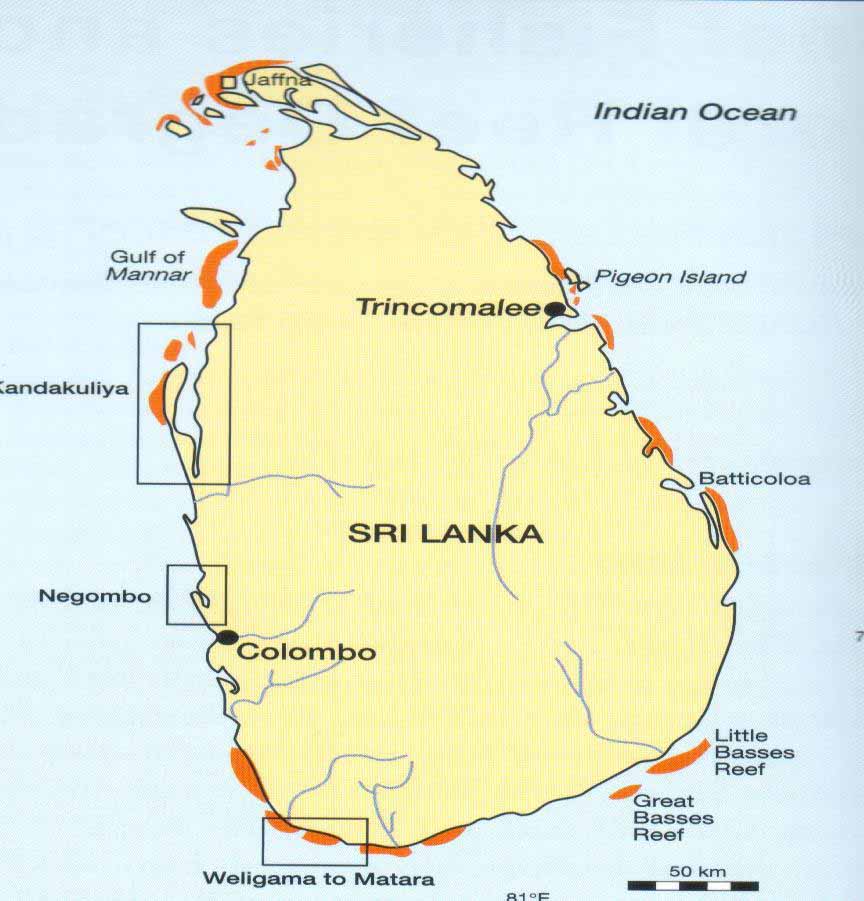
Coral reefs are among the most productive and biologically diverse ecosystems on earth – they provide a multitude of valuable ecosystem services. The resources derived from coral reefs are essential to the food security of millions of people living within tropical coastal communities. Coral reefs in Sri Lanka categorized into three types. They are, (01) true coral reefs consisting of live corals as well as calcareous substances, (02) sandstone reefs, and (03) rocky reefs. The later two reef types may also be covered by corals in varying degree. All three habitats are distinctly different, but may be found mixed together.
Distribution of Coral reef habitats in Sri Lanka
Important of coral reef ecosystem
Ø Breeding and nursery grounds for marine life
Ø As a natural breakwater
Ø Providing coral sand for shoreline development
Ø Providing medicinally important compounds
Ø High biodiversity
Ø Provide food products and building materials.
Ø As attraction areas for tourists.
Ø Important for research & scientific studies
LAGOONS & ESTUARYS –
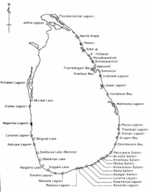
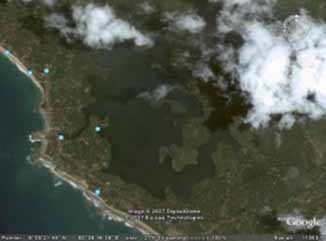
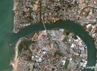
Some main Lagoons and Estuaries in Sri Lanka
Definition of Lagoon
‘Coastal bodies of water that may be brackish, fresh or hyper saline, and are separated from the sea over a very long period of time by any of several types of barriers that restrict water circulation’.
Definition of Estuary
“Natural systems that are transitional between rivers/ streams and the sea, and within which the salinity of the water is measurably different from the salinity in the open ocean. All estuaries have free connection with the open sea – either continuously or intermittently”.
SAND DUNES –
Sandy beaches offer an exposed source of sediment and so almost all sandy beaches are fringed by some form of sand dune formed by sand transported by wind action and deposited in the vegetation landward of the beach.
Sand dunes distribution in Sri Lanka
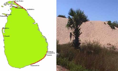
Important of Sand dune ecosystem
Ø Rich biodiversity
Ø Scenic beauty and ideal for recreation
Ø Natural barriers for control erosion
Ø Wind barriers and protect hinterlands
Ø Typical features of Coastal stability
Ø Provide protection against flooding
Ø Educational and research
SEAGRASS BEDS-
Sea grasses are flowering plants that thrive in shallow oceanic and estuarine waters and are descendants of terrestrial plants that re-entered the ocean between 100 and 65 million years ago. They have leaves, stems, rhizomes and roots. Sea grass beds often occur in sheltered waters combined with coral reef ecosystem of estuaries and lagoons.
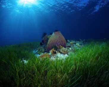
Important of Sea grass beds
Ø Breeding or nursery grounds for numerous species of fish,
Ø Large filters to extract pollutants excess nutrients and sediments.
Ø Rich biodiversity
Ø Carbon sequestration
Ø Educational and research
COASTAL PROCESS
Factors of Importance for the Coastal Process
*Wind
*Waves
* Short waves
*Long waves
*Currents
*Tidal currents
*Long shore currents
*Rip currents
Short waves wind waves and swell periods less than approximately 20 s
Wind waves (Sea waves)
Generated and influenced by the local wind field. Generally relatively steep (high and short) and are both irregular and directional.
Swell
Waves which have been generated by wind fields far away and have traveled long distances over deep water away from the wind field which generated the waves. Direction of propagation is not necessarily the same as the local wind direction. Often relatively long, of moderate height, regular and unidirectional
Sediment Transport Processes
Littoral Transport (Alongshore Sediment Transport) due to prevailing wave direction
Onshore – Offshore Transport
During storms (monsoon) : offshore transport, narrow beaches, offshore bar formation
During swell dominated periods (non-monsoon) : onshore transport, wide beaches
Sediment Sources-
Ø Supplied by Rivers
Ø Supplied by Coral reefs
Ø Supplied by Erosion of Land
Near shore Coastal Process –
Wave speed and length reduce, wave height increases and the waves become steeper waves become unstable due to increased steepness and break wave speed in shallow areas depends on the depth and waves approaching at an angle to sea bed contours change the direction and tend to become parallel to sea bed contours/coastline run-up and overtopping also take place in the vicinity of the coastline
Coastal processes generate near shore currents that cause sediment transport (sand movement)
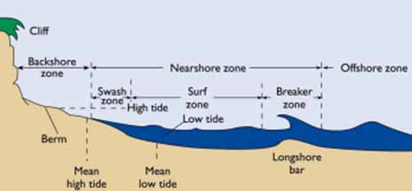
Swash and backwash
Wave run-up or swash is driven primarily by the momentum of the wave itself and is moderated by the beach slope and infiltration into the sediments. The return flow of the backwash is driven primarily by gravitational forces and thus depends on the beach slope and on the volume of water remaining. The dynamics of the swash zone are critical to the exchange of sediment between the beach and the near shore and to the evolution of the beach form in response to changing wave and water level conditions. Swash zone dynamics varies considerably along the continuum between steep and gently sloping beaches
Near shore Currents and Sediment Transport
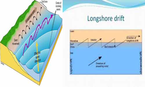
Two main types of near shore currents can exist in coastal areas that cause sediment transport along with them: Long shore currents and sediment transport: Currents along the coast generated by breaking of refracted waves at an angle to the coastline and the accompanying sediment transport
On/offshore currents and sediment transport: Currents in onshore and offshore directions due to wave up-rush and down-rush and accompanying sediment transport
Tidal currents are also present, but are usually small due to low tidal range in Sri Lanka, but significant local currents and accompanying sediment transport can occur across narrow tidal inlets
In Sri Lanka, the following general sediment patterns have been reported:
During south-west monsoon: northwards along the south-western, western and south-eastern coasts and eastwards along the southern coast
During north-east monsoon: southwards along the western, south-western and eastern, south-eastern coasts and westwards along the southern coast
A coastline can reach a dynamic equilibrium profile under a specific wave climate which may indicate seasonal variations corresponding to the seasonal changes in wave conditions. In Sri Lanka, seasonal beach erosion during monsoonal periods and beach recovery during non-monsoonal period have been reported in many locations
The near shore current speeds and the accompanying sediment transport rates depend on a number of characteristics such as wave height, angle of approach, sediment size etc and many local variations of these characteristics can occur along a coastline Coastal erosion (and/or accretion) can be considered in terms of sediment budget for a coastal cell containing the area of interest
Sediment Budget of a Coastal Cell and Coastline Behavior
Sediment transport processes in a coastal cell are indicated in the figure below:
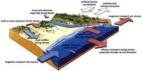
• If, sediment outflow rate < sediment inflow rate: coastal accretion in the area
• If, sediment outflow rate > sediment inflow rate: coastal erosion in the area
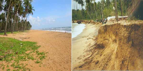
Coastal accretion Coastal erosion
COASTAL PROCESSES AND LANDFORMS –
There are two types of Landforms
(1) Erosional Landforms
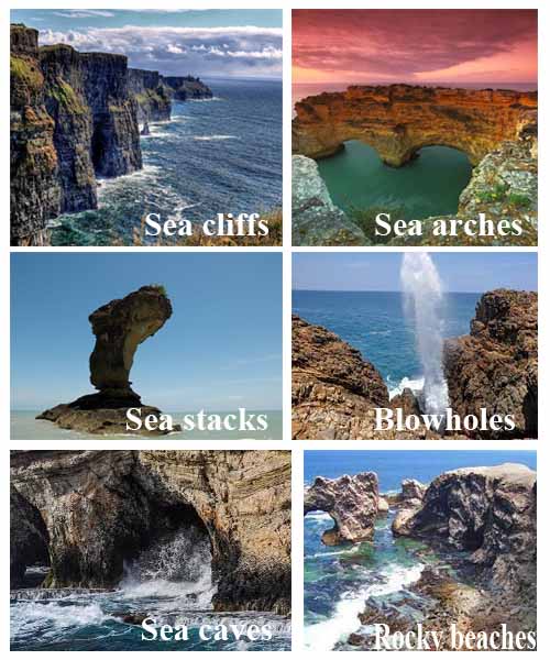
Sea cliffs Sea arches
A Sea stack
Sea stacks Blowholes
Sea caves Rocky beaches
(2) Depositional landforms
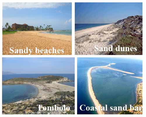
Sandy beaches Sand dunes
Tombolo Coastal sand bars
COASTAL EROSION –
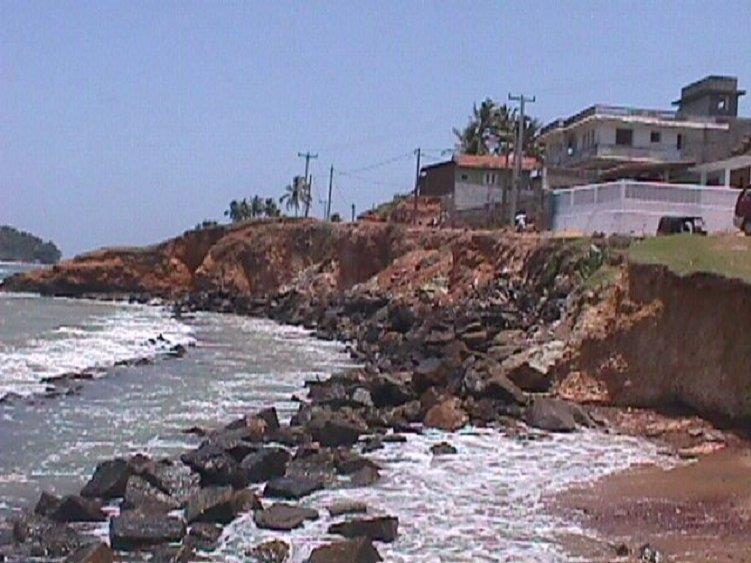
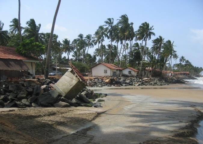
Among the other factors, the most important factor contributing to coastal erosion in Sri Lanka is the
Imbalance of the littoral sediment budget. The littoral transport results mainly from the action of monsoon generated short crested wind waves and long crested swell waves on the near shore sediment. Thus coastal erosion through the actions of waves, currents and winds results in the loss of sediment in some places.
There is a considerable variation in the supply of sediment to the beach and loss of sand from the beaches due to the long shore transport capacity. The erosion taking place in the southwest coast is mainly due to the high capacity of littoral drift than the supply from the rivers to the beaches. The erosion reported from the coastal stretch located north of Negombo is compounded by the straightness of the coastline and is particularly severe because of a high deficit in the littoral budget due to sand mining in the Maha Oya.
As per the prevailing information, sand supply along the south coast is also low, but the coastline is relatively stable due to the bay and headland features predominant. The global sea level is expected to rise with 30- 40 cm in the 21st century according to the International Panel for Climate Change mid estimates based on the linear melting of the ice sheets of Greenland and Antarctica due to increased emission level of green house gases. Thus it is difficult to disregard the potential increase of coastal erosion due to sea level rise. However, it is more complicated to quantify the level of erosion when it comes to coastlines in the vicinity of inlets, such as river mouths, lagoons and estuaries. These places are affected by other factors, such as inundation with heavy rainfall, basin filling impacts and impacts due to salt water intrusion. Those impacts along the water bodies will be accelerated remarkably with sea level rise.
One of the causes of natural coastal erosion is an increasing gradient in transport rate in the direction of the net transport of the system. This can be due to changes in the wave conditions at certain stretches, a curved coastline, or special bathymetric conditions. The loss of sand inland due to breaching and over-wash of barrier islands and wind transport lost to offshore during extreme wave and storm surge conditions. The high waves cause the bars to move seawards and the high storm surges also cause an offshore movement of sand due to non-equilibrium in the profile during the high surge.
The loss of sand to an accumulative beach occurs at the tip of a sand spit and into deep water at the
seaward side of the tip of sand spit at the termination point of a littoral cell. Sand lost in this way causes accumulative shore and shoal features in the deposition areas, but the upstream coastline has lost the sand.
The loss of material from a protruding area to one or two sides is a natural cause of coastal erosion. Erosion can occur of the marine deposit shorelines suspended between sections of protruding semi-hard sections of the coastline, such as sandstone. The hard sections have historically provided
material for building up the sedimentary shorelines. The shape of these shorelines is consequently dependent on the presence of the semi-hard sections and the wave climate. However, as the semi-hard sections continue to erode, the sedimentary shorelines will follow suit despite the fact that they were originally accumulative forms. Another cause of natural coastal erosion is very oblique wave approach to the coastline. Along such coastlines there is a tendency for the natural formation of spits parallel to the coast. They accumulate the sand and shift the sand supply offshore, which means that the downstream coastline is starved and begins to erode.
Nature of the Problem-
Coastal erosion is a significant and continuing problem in varying degree in Sri Lanka, which results
in socio-economic and environmental repercussions. Erosion occurs due to both natural causes and
Anthropogenic interventions and entails public and private cost. These include the loss of beaches, disruption of recreational and tourism activities, damage to public and private properties and infrastructure. It also includes a substantial annual expenditure on coast protection, emergency and disaster relief work. According to current information, a sum of SL Rs. 1520 million has been spent on coastal erosion management during the period 1985 – 1999, SL Rs. 3 billion spent during 2001- 2007 under the ADB funded Coastal Resources Management Project. In addition a further amount of US$ 1.4 Million was spent on coastal rehabilitation under the Tsunami Affected Area Rehabilitation Programme (TAARP). Beside this, a total of two billion rupees was spent on sand replenishment and other major coast protection in southern, western and north western coastal stretches to date. However, the incidence of coastal erosion reported from the northern and the eastern coastal segments of the country during the last three decades was insignificant. Similarly the investment incurred on coast protection was also at minimum level in respect of the northern and the eastern coastal segments.
Reduction in supply of sand to the beaches is identified as one of the crucial factors underlying the coastal erosion problem. Long shore currents created by the wind and swell waves, mainly transported sand from one location to other location along coast. It is a continuous process and erosion is not significant if the coast comprises of beaches with sufficient continuous supply of sand. If sufficient sand supply is not available in the beaches to accommodate the long shore transport process or if the beach is blocked by coastal structures, then the coastal erosion is inevitable in the adjacent beach.
As per the current information available with CC & CRMD, a high rate of coastal erosion has been reported from the coastal segment lying north of Lansigama during the last five years (2007-2012), similar to the higher erosion rates reported during 2000- 2005 in Mahaoya- Lansigama coastal segment. Similarly, a significant coastal erosion (localized) rate has been reported from the coastal stretch lying north of Oluvil Harbor in 2010. In terms of coastal accretion, the reported rates are lower than the coastal erosion rate and only occur in a few locations. Period of 2010 -2013 demonstrates that despite the management strategies adopted through structural and non-structural solutions, coastal erosion is a continuing problem in the country
COASTAL PROTECTION & MANAGEMENT METHODS IN SRI LANKA –
Main Solution Methods-
Ø Hard Solutions
Ø Soft Solutions
Ø Management Solutions
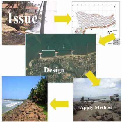
ISSUE INVESTIGATION
DESIGN
APPLY METHOD
Hard Solutions-
Revetments Groins Offshore break waters
Seawalls Gabion walls Emergency Coast Protection works
Revetments-
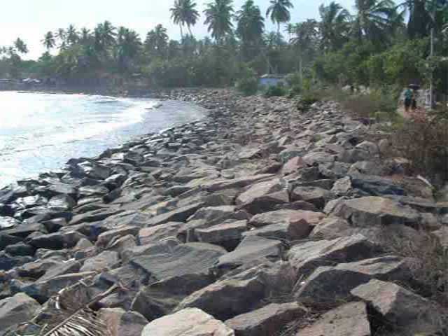
Revetments are shore-parallel structures designed to protect shorelines against erosion by light to moderate wave action or by currents.
Two types of Revetments.
Ø Flexible armor unit type
Ø Rigid, concrete type
REVETMENTS
Groins-

Groin is a rigid hydraulic structure that traps sand transported by the long shore currents.
It is usually made out of wood, concrete or stone. In the ocean, groins create beaches or prevent them being washed away by long shore drift consequently, down coast erosion may take place due to lack of sand.
Groins are structures built normal or nearly normal to the shore line to save an eroding beach.
This way the zone of erosion is
shifted out of the immediate area, but effectively the erosion problem is only
transferred to somewhere down coast.
Off shore break waters-
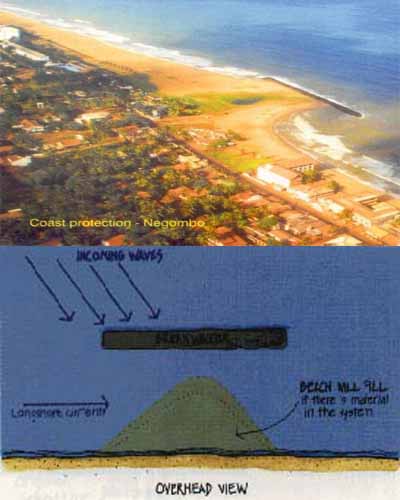
Off-shore breakwaters are shore-parallel structures constructed off-shore in water depths between 1.5 – 8 m, for shore protection.
These structures work by causing a zone of reduced wave activity behind the breakwater where sediment will tend to deposit.
It reduces the offshore sand transport
During storms; can also reduce onshore sand movement during normal, swell wave conditions.
2. Sector: Environment
Sea walls-
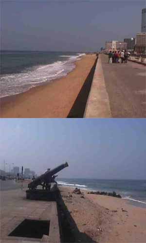
Seawalls are massive shore-parallel structures built to assist the shoreline in resisting major storm events accompanied by large, powerful waves.
They also prevent inland
flooding from major storms.
Gabion walls-
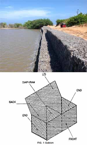
A gabion wall is a retaining wall made of stacked stone-filled gabions tied together with wire.
Gabion walls are usually battered (angled back towards the slope), or stepped back with the slope, rather than stacked vertically.
Emergency Coast Protection-
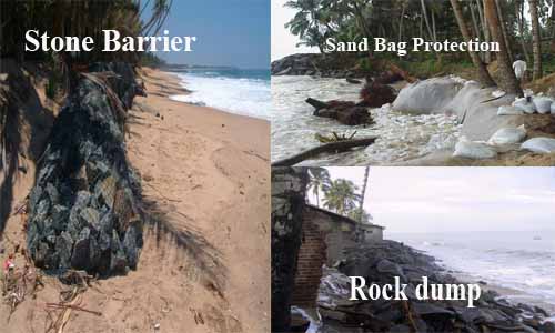
Stone Barrier Sand bag Protection
Rock dump
Disadvantages of the Hard solutions
Ø User conflicts
Ø Transfer the problem to other areas
Ø Loses the beaches
Advantages of the Hard solutions
Ø Relatively less cost
Ø Technology available
Ø Immediate actions
Ø Availability of materials
Soft
Solutions-
Ø Beach Nourishment
Ø Rehabilitation of Coastal habitats
Ø Planting of Coastal vegetation
Beach Nourishment
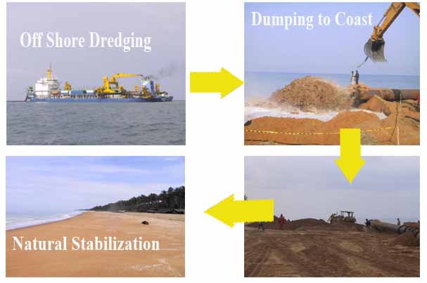
Off shore dredging Pumping to coast
Natural stabilization Profiling
Rehabilitation of Coastal habitats-
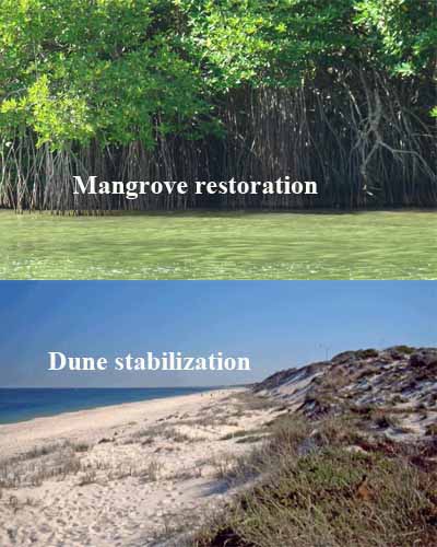
Mangrove restoration Dune stabilization
Planting Coastal Vegetation-
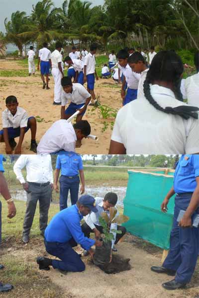
Advantages of the soft solutions
Ø Minimize the user conflicts
Ø Long term solutions
Disadvantages of the soft solutions
Ø Relatively high cost
Ø Technology
Ø High maintenance cost
Ø Capital cost
Management Solutions-
Ø Introduce Set backs for new constructions
Ø Institutional arrangements and zoning plans
Ø Awareness and Educations
Introduce of Set backs for new constructions
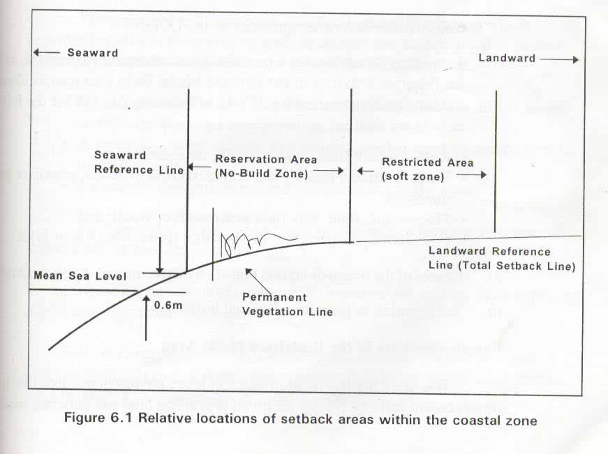
“Set back is a geographical strip with in the Coastal Zone which certain development activities are prohibited or significantly restricted”
Institutional arrangements and zoning plans-
Ø Coast Conservation and Coastal Resources Management Act
Ø National Coastal Zone and Coastal Resources Management plan
The Coastal Zone Management Plan (CZMP) is the plan of action adopted by the Coast Conservation Department (CCD) for management of the Coastal Zone during a five year period. It is designed to ensure sustainable use of the coastal environment and its resources in the long-term, while satisfying current national development goals.
In compliance with the Coast Conservation and Coastal Resources management Act No.57 of 1981, the foremost Coastal Zone Management Plan for Sri Lanka was prepared in 1990.The CZM Plan was revised in 1997, 2004 and 2018 respectively fulfilling the mandatory legal requirements of the Coast Conservation and Coastal Resources management Act No.57 of 1981.
Special Management Areas (SMA)-
Special Management Area (SMA) has been identified as one of the important management tools in the field of Integrated Coastal Resources Management (ICRM) when the coastal resources are subject to increasing pressure from economic development, increasing population and poverty conditions in the coastal region in Sri Lanka.
The concept of Special Management Area (SMA) evolved based on the co-management principles and involves a collaborative, adaptive and flexible approach to resource management within a defined geographic area.
Declaration of Conservation areas-
The minister may by order published in the Gazette, declare as a “ Conservation Area” , any area in which special measures need to be taken for the protection of the coastal and aquatic eco-system
Declaration of Affected Areas-
The Minister may by order published in the Gazette declare any area, Within the Coastal Zone or adjacent to the Coastal Zone or filling within both such areas ; or Within any water body or part of any water body ; or Within any lagoon or part of any lagoon or any peripheral area of lagoon
Introduce a Permit system for development activities within the coastal zone-
A permit should be obtained from the Coast Conservation & Coastal Resource Management Department prior to engage any development activity within the coastal zone according to Coast Conservation and Coastal Resources management Act No.57 of 1981.
Types of Permit-
Type “A” permit
The development activity which require EIA or IEE
Type “B” permit
The development activity that do not require EIA or IEE
Implement of EIA/IEE for large scale development projects like Port City Project within the coastal zone
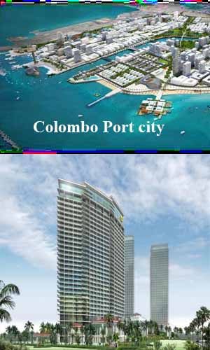
Colombo Port city
A Permit is Required activities in the Coastal Zone-
Ø Dwelling houses and related structures
Ø Tourism, commercial and industrial structures
Ø Recreational and/or water sport facilities
Ø Harbor structures and navigation channels
Ø Roads, bridges and railway lines
Ø Public and religious structures
Ø Shoreline protection works to be carried out by any private individual or group
Ø Sewage treatment facilities and ocean outfalls
Ø Aquaculture facilities
Ø Disposal of solid waste
Ø Dredging Filling, Grading or Breaching of sand bars
Ø Construction of structures to prevent bank erosion and filling of any water area within
a water body located within the Coastal Zone
Ø Landscaping
Ø Mining and mineral extraction
Ø Removal of coral for research purposes
Ø Power generation projects
Ø Waste water discharge facilities
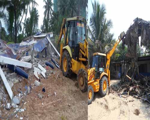
Enforcement of Lows-
(Demolition of Illegal constructions within the coastal zone according to Coast Conservation & Coastal Resources management Act)
Awareness and Education-
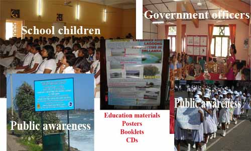
School children Government officers
Education materials
Posters
Booklets
CDs
Public awareness
References-
National Coastal Zone & Coastal Resources Management Plan
Coastal Process (Un published) – Dr. Anil Premarathna
Coastal Protection Methods (Un published) – Eng. Sakuntha Pathmasiri


